Cairo
2007 Schools Wikipedia Selection. Related subjects: African Geography; Geography of the Middle East
| The Triumphant City (ﻤﺪﻴﻨﺔ القاهرة) | |||||
|
|||||
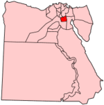
| Cairo's location in Egypt | |||||
| Coordinates: | |||||
|---|---|---|---|---|---|
| Governor | Dr. Abdul Azim Wazir | ||||
| Area | |||||
| - City | 210 km² | ||||
| - Metro | 1,492 km² | ||||
| Population | |||||
| - City (2005) | 7,438,376 | ||||
| - Density | 35,420/km² | ||||
| - Urban | 10,834,495 | ||||
| - Metro | 15,200,000 | ||||
| Time zone | EET ( UTC+2) | ||||
| - Summer ( DST) | EEST ( UTC+3) | ||||
Cairo ( Arabic: القاهرة translit: al-Qāhirah) comes from the Arabic word "قاهرة" meaning "Triumphant". It is the capital city of Egypt (previously the United Arab Republic). It has a metropolitan area population of approximately 15.2 million people. Cairo is the seventeenth most populous metropolitan area in the world (the 10th according to 2004 statistics). Cairo is also the most populous metropolitan area and the most populous city in Africa. The city is located at 30°2' North, 31°13' East (30.03333, 31.21667).
While al-Qāhirah is the official name of the city, in local speech it is typically called simply by the name of the country, Miṣr (Arabic, مصر) pronounced Maṣr in the local dialect.
Geography
Cairo is located on the banks and islands of the Nile River in the north of Egypt, immediately south of the point where the river leaves its desert-bound valley and breaks into two branches into the low-lying Nile Delta region.
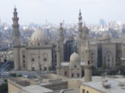
The oldest part of the city is somewhat east of the river. There, the city gradually spreads west, engulfing the agricultural lands next to the Nile. These western areas, built on the model of Paris by Ismail the Magnificent in the mid-19th century, are marked by wide boulevards, public gardens, and open spaces. The older eastern section of the city is very different: having grown up haphazardly over the centuries it is filled with small lanes and crowded tenements. While western Cairo is dominated by the government buildings and modern architecture, the eastern half is filled with hundreds of ancient mosques that act as landmarks.
Extensive water systems have also allowed the city to expand east into the desert. Bridges link the Nile islands of Gezira and Roda, where many government buildings are located and government officials live. Bridges also cross the Nile attaching the city to the suburbs of Giza and Imbabah (part of the Cairo conurbation).
West of Giza, in the desert, is part of the ancient necropolis of Memphis on the Giza plateau, with its three large pyramids, including the Great Pyramid of Giza Approximately 11 miles (18 km) to the south of modern Cairo is the site of the ancient Egyptian city of Memphis and adjoining necropolis of Saqqara. These cities were Cairo's ancient predecessors, when Cairo was still in this approximate geographical location.
History of Cairo
Founding and early history
The current location of Cairo was too far from the ancient course of the Nile to support a city. Just to the south of the modern city's location are the ruins of Memphis, which was the capital of Ancient Egypt and was founded in around 3100 BC by Menes of Tanis after he had united the two kingdoms of Upper and Lower Egypt, although the capital later moved to Heliopolis, further south to Thebes, and, under the Ptolemaic dynasty, Alexandria.
The first settlement on the location of modern Cairo was a Roman fort, known as Babylon Fort, built about AD 150, built near the settlement known as Babylon-in-Egypt, which lay close to an ancient Egyptian canal from the Nile to the Red Sea.
A small town mostly of Coptic Christians slowly grew around the fort. Arab invaders, lead by Amr ibn al-As, took the fort town in 642 and also established their army in the location, rebuilding its defenses. The Arab tented camp outside the fortress, known as Al-Fustat, slowly became the permanent base of the Arab forces in Egypt under the Umayyads and Abbasids, and contains the first mosque in Africa.
Slowly, the settlement grew into a small city. The North African Shi'i Fatimid Dynasty conquered Egypt in 972 and built a new capital, al-Mansuriyyah, north of the old settlement.
The Al-Azhar mosque was founded the same year, and along with its accompanying university it made Cairo a centre of learning and philosophy. The school remains a major centre for Islamic study today. The Seljuks captured Cairo in the mid 1100s, and Saladin and his successors expanded the city further, including the construction of its massive citadel.
The sack of Baghdad in 1258 heightened the importance of the city and it became the leading intellectual and artistic centre in the Middle East, and perhaps the world, for the next 250 years. It is believed that Cairo was the largest city in the world from 1315 to 1348 (years of the Black Death), though, as has been shown by Andre Raymond (Cairo: City of History. Cairo: AUC, 2001. P. 136-137), this is a gross exaggeration, and Cairo's population did not exceed 200,000 at this time. But power was shifting from the Arab world north to the Turks and Europeans.
The city was taken by the Ottoman Empire under Selim I in 1517, but in the 17th and 18th centuries the ruling Mameluks returned to power as nominal vassals to the Ottoman Sultan.
The family of 26th Ottoman sultan Selim III died on the way to Medina. They have been buried in an impressive Ottoman mausoleum in the old quarter of Cairo. The mausoleum is still a favorite place to visit for Turkish tourists.
Era of westernization
Napoleon conquered Egypt in 1798, and Cairo was quickly surrendered to him by its Mameluk rulers. Napoleon left Egypt after his fleet was destroyed at the Battle of Aboukir Bay in August 1798, leaving General Kléber in charge. Kléber was assassinated in 1800 and the three-year French occupation had little lasting effect.
The first hints of westernization began under the successors to Mehemet Ali with the introduction of a railway connection to Alexandria in 1851. Significant change, however, did not occur until the reign of Isma'il Pasha when, in 1863, construction of the Suez Canal brought significant numbers of westerners to Egypt. A network of gas lighting was installed by a French company and the railway lines were greatly expanded.
In 1867, Isma'il visited Paris to attend the Universal Exposition of 1867. There he saw the newly redesigned city of Haussmann and, funded by a booming cotton trade, decided to rebuild Cairo on the model of a European capital. He hoped to have this done by 1869 when representatives from around the world came to Egypt for the opening of the Suez Canal.
Rather than rebuild the old city, Isma'il elected to add a new quarter to the western section along the bank of the Nile. The project was carried out by Ali Pasha Mubarak and designed by the French urban planner Pierre Grand. A new area of luxurious villas and apartments was constructed and new government ministries were erected. Grand boulevards were opened through the old town and tram lines soon followed.
The era of colonization in 1882 saw the rebuilding of Cairo continuing. A modern sewer system was installed and new suburbs such as Heliopolis were constructed in the desert. Cairo's population exploded, increasing from 374,000 in 1882 to 1,312,000 by 1937. The city was dominated by westerners, however, and city planners tended to emphasize Christian churches over mosques.
Modern Cairo
Cairo remained the central city of Egypt throughout the period of British rule and afterwards. The 20th century saw massive growth in the size of the city as peasants left the farmlands in pursuit of work in the factories and commerce of the metropolis. The city was especially burdened by refugees from the various wars with Israel: much of the population of the Sinai peninsula and the cities along the Suez Canal left for Cairo between 1967 and 1978.
Today, Cairo is Africa's most populous city and the Arab world's cultural centre.
Since the 19th century Cairo has also become a centre for tourism as people from around the world have come to see the monuments and artifacts of Ancient Egypt, especially the Pyramids. Laws against the export of these treasures has meant that the Egyptian Museum in Cairo is the only place in the world that many items can be seen.
Cairo has many malls and shopping centers; the most popular is Citystars , which is the second largest mall in the world and has an 18 screen cinema and theme park .
Skyscrapers are now being built all over Cairo inculding Nile City Towers , The National Bank of Egypt Towers, The Fairmont Cairo , New Cairo City Towers and The New Saudi Arabian Embassy Tower.
Images
Infrastructure
Health
Cairo, as well as neighbouring Giza, have been established as Egypt's main centre for medical treatment, as well as a major Health Centre in the Middle East. Some of Cairo's most famous hospitals are Al-Salam International Hospital, Ain-Shams University Hospital, as well as Qasr El Ainy General Hospital.
See List of hospitals in Egypt.
Transport
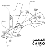
The subway system, called 'The Metro' locally, is a fast and efficient way of getting around Cairo. It can get very crowded during rush hour. There is also usually a carriage at the front of the train that is reserved for women only.
- Cairo International Airport
- Cairo Metro
- CTA
- CitiCab
Education
Cairo has long been the hub of education and educational services not only for Egypt but also for the whole world. Today, Cairo is the centre for the government offices governing the Egyptian educational system, has the largest number of educational schools, and higher learning institutes among other cities and governorates of Egypt.
Some of the International Schools found in Cairo include:
- British International School in Cairo (BISC)
- Cairo American College (CAC)
- Collège de la Ste Famille (CSF)
- International School of Choueifat
- Modern English School (MES)
Universities in Cairo:
- Ain Shams University
- El Shorouk Academy
- Al-Azhar University
- AlAhram Canadian University (ACU)
- American University in Cairo (AUC)
- Arab Academy for Science & Technology and Maritime Transport
- British University in Egypt (BUE)
- Cairo University
- French University in Egypt
- German University in Cairo (GUC)
- Helwan University
- Higher Technological Institute (HTI)
- Misr International University (MIU)
- Misr University for Science and Technology(MUST)
- Modern Academy In Maadi
- Modern University for Sciences and Technology (MSA)
- Sadat Academy For Management Science
- Higher Technological Institute (HTI) 10th of Ramadan City
Sports
Cairo has a number of sporting teams that compete in national and regional leagues. The best known teams are Al-Zamalek and Al-Ahly, whose annual football Local derby is perhaps the most watched sports event in Egypt as well as the Africa and Arab World. Both teams are known as the giants of Egyptian football, and are champions in the African continent and the Arab World. Both teams play their home games at Cairo International Stadium, which is Cairo's and Egypt's largest stadium and one of the largest in Africa
The Cairo International Stadium was built in 1960 and its multipurpose sports complex that houses the main Soccer stadium, an indoor stadium, several satellite fields that held several regional, continental and global games, including the African Games, U17 Football World Championship and was one of the stadiums scheduled that hosted the 2006 African Nations Cup which was played on January, 2006, which Egypt won its title for the record number of five times in African Continental Competition's history.
Cairo failed at the applicant stage when bidding for the 2008 Summer Olympic Games, which will be hosted in Beijing China. Egypt was unsuccessful in bidding to host the 2010 Football World Cup, which will be held in South Africa. However, Egypt will host the Pan-Arab Games in 2007.
There are several other sports teams in the city that participate in several sports including Al Gezeera Sporting Club, Al Shams Club, Shooting club, Heliopolis Club and several smaller clubs, but the biggest clubs in Egypt (not in area but in sports) are Al Ahly & Al-Zamalek. They have the two biggest football teams in Egypt.
Most of the sports federations of the country are also located in the city suburbs, including the Egyptian Football Association. The headquarters of the Confederation of African Football(CAF) was previously located in Cairo, before relocating to its new headquarters in 6th October City.
Pollution
Cairo is a rapidly expanding city which has lead to many environmental problems. There are over 2,000,000 cars on the streets of Cairo, 60% of which are over 10 years old, and therefore lack modern emission cutting features like catalytic converters. Cairo also has many unregistered lead and copper smelters which heavily pollute the city. The results of this has been a permanent haze over the city with particulate matter in the air reaching over three times normal levels. It is estimated that 10,000 to 25,000 people a year in Cairo die due to air pollution-related diseases. It is also estimated that the high lead content of the air can reduce a child's IQ on average by 4 points. In 1995, the first environmental acts were introduced and the situation has seen some improvement with 36 air monitoring stations and emissions tests on cars. 20,000 buses have also been commissioned to the city to improve congestion levels, which are very high.
The city also suffers from a level of land pollution. Cairo produces 10,000 tonnes of rubbish each day, 4,000 tonnes of which is not collected or managed. This once again is a huge health hazard and the Egyptian Government is looking for ways to combat this. The Cairo Cleaning and Beautification Agency was founded to collect and recycle the rubbish; however, they also work with the Zabbaleen, a Christian community that has been collecting and recycling Cairo's rubbish since the turn of the 20th century . Both are working together to pick up as much rubbish as possible within the city limits, though it remains a pressing problem.
The city also suffers from water pollution as the sewer system tends to fail and overflow. On occasion, sewage has escaped onto streets creating a health hazard. This problem is hoped to be solved by a new sewer system funded by the European Union, which could cope with the demand of the city. The dangerously high levels of mercury in the city's water system has global health officials concerned over related health risks.
Housing
Cairo is facing a housing problem. The lack of satisfactory and affordable housing for the rapidly growing population has forced many poor Egyptians to make cemeteries in the city of the Dead as their permanent homes. Among these cemeteries live a community of Egypt’s urban poor, forming an illegal but tolerated, separate society. More than five million Egyptians live in these cemeteries, and have formed their own enterprises. The population of the City of the Dead is growing rapidly because of rural migration and its complicated housing crisis is getting worse.
Famous Cairenes
- Abu Sa'id al-Afif - Fifteenth Century Samaritian
- Boutros Boutros-Ghali, former Secretary-General of the United Nations
- Mohamed ElBaradei, 2005 Nobel Peace Prize laureate
- Ahmed Hossam, football player
- Naguib Mahfouz, 1988 Nobel Prize laureate in literature and novelist
- Omar Sharif, Academy Award-nominated actor
Districts
| Districts of Cairo | |
|
Agouza | Abbassia | Ain Shams | Bulaq | Dokki | Downtown Cairo | El-Manial | El-Marg | El-Quba | El-Tagamu El Khames | Embaba | Garden City | Giza | Haram | Heliopolis | Islamic Cairo | Kerdasa | Maadi | Mataria | Mohandessin | Muqatam | Nasr City | Old Cairo | Rhoda | Shoubra | Shubra El Khiema | Zaitun | Zamalek |
|


