Cotswolds
2007 Schools Wikipedia Selection. Related subjects: Geography of Great Britain
The Cotswolds is a range of hills in central England, sometimes called the "Heart of England", a hilly area reaching over 300 m or 1000 feet. The area has been designated as the Cotswolds Area of Outstanding Natural Beauty. The highest point in the Cotswolds is Cleeve Hill at 330m/1083ft.
The Cotswolds lie within the current ceremonial counties of Oxfordshire, Gloucestershire, Wiltshire, Somerset, Warwickshire, and Worcestershire. The county of Gloucestershire forms the largest area of the Cotswolds.
Description
The spine of the Cotswolds runs southwest to northeast through six counties (see note above), particularly Gloucestershire, Oxfordshire, and southern Warwickshire. The northern and western edges of the Cotswolds are marked by steep escarpments down to the Severn valley and the Avon. This escarpment or scarp feature (sometimes called the Cotswold Edge) is a result of the uplifting (tilting) of the limestone layer, exposing its broken edge. This is a cuesta, in geological terms. The dip slope is to the southeast. On the eastern boundary lies the city of Oxford and on the west is Stroud. To the south the middle reaches of the Thames Valley and towns such as Cirencester, Lechlade, Tetbury, Beverston and Fairford are often considered to mark the southern limit of this region. However, key features of the area, especially the characteristic uplift of the Cotswold Edge, can be clearly seen as far south as Bath and towns such as Chipping Sodbury and Marshfield share elements of Cotswold character.
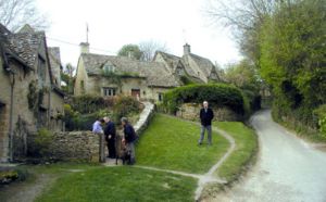
The area is characterised by attractive small towns and villages built of the underlying Cotswold stone (a yellow oolitic limestone). This limestone is rich in fossils, in particular fossilised sea urchins. In the Middle Ages, the wool trade made the Cotswolds prosperous; hence the Speaker of the British House of Lords sits on the Woolsack showing where the Medieval wealth of the country came from. Some of this money was put into the building of churches so the area has a number of large, handsome Cotswold stone " wool churches". The area remains affluent and has attracted wealthy people who own second homes in the area or have chosen to retire to the Cotswolds.
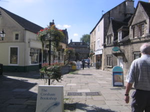
Typical Cotswold towns are Bourton-on-the-Water, Broadway, Burford, Chipping Norton, Cirencester, Moreton-in-Marsh, Stow-on-the-Wold and Winchcombe. The village of Chipping Campden is notable for being the home of the Arts and Crafts movement, founded by William Morris at the end of the 19th and beginning of the 20th centuries. William Morris lived occasionally in Broadway Tower a folly now part of a country park. Chipping Campden is also known for the annual Cotswold Games, a celebration of sports and games dating back to the early 17th century.
Area of Outstanding Natural Beauty
The Cotswolds were designated as an Area of Outstanding Natural Beauty in 1966, with an expansion on 21 December 1990 to 1,990 square kilometres. In 1991 all AONBs were measured again using modern methods. The official area of the Cotswolds AONB increased to 2,038 square kilometres. In 2000 the government confirmed that AONBs had the same landscape quality and status as National Parks. 2006 is the 40th anniversary of The AONB.
The largest of 40 AONBs in England and Wales, the Cotswolds AONB stretches from the border regions of South Warwickshire and Worcestershire, through West Oxfordshire and Gloucestershire and takes in parts of West Wiltshire and Bath and North East Somerset in the South.
The Cotswold Way is a long-distance footpath (approx 103 miles) running the length of the AONB, mainly on the edge of the Cotswold escarpement with good views over the Severn Valley and the Vale of Evesham.
The Cotswold Voluntary Wardens Service was established in 1968 to help conserve and enhance the area. There are now over 300 Wardens. In 2005 they gave over 36,000 hours of their time.
Noteworthy historical structures
- Beverston Castle
- Calcot Manor
- Chavenage House
- Chedworth Roman Villa
- Cirencester Abbey
- Malmesbury Abbey
- Owlpen Manor
- Sudeley Castle
- Tetbury Market House
Transport
The Cotswolds is ringed by the M5, M40 and M4 motorways, giving easy car access to the area. The main non-motorway roads through the area are the A46: Bath — Stroud — Cheltenham; the A419: Swindon — Cirencester — Stroud; the A429: Cirencester — Stow on the Wold — Moreton-in-Marsh; and the A40: Oxford — Burford — Cheltenham. These all roughly follow the routes of ancient roads, some laid down by the Romans, such as Ermin Street and the Fosse Way.
The area is bounded by two major rail routes: in the south by the main Bristol-Bath-London High Speed line and in the west by the Bristol-Birmingham main line. In addition, the Golden Valley Line runs from Swindon to Gloucester, carrying high speed and local services.
Main line, high speed rail services to the big cities are reached via stations such as Bath, Swindon, Oxford, Cheltenham and Worcester. High speed services to London are also available from smaller stations at Kemble near Cirencester, Kingham Station near Stow on the Wold and Moreton-in-Marsh station.
Cheltenham is a hub for National Express coach services. Local bus services across the area do exist, but are infrequent. The best source of information is the local tourist offices.
Note on counties
Between 1974 and 1995 parts of the AONB fell within the newly formed administrative and ceremonial County of Avon. After 1995 Avon was divided between four administrative unitary authorities with 'shadow county' status, the relevant ones for the AONB being South Gloucestershire and Bath and North-East Somerset. For ceremonial purposes these counties are returned to their pre-1974 lord lieutenancies.

