Image:Oregon population map.png
From Wikipedia, the free encyclopedia
Oregon_population_map.png (740 × 460 pixel, file size: 30 KB, MIME type: image/png)

Summary
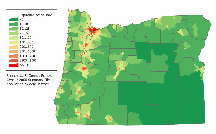
Oregon state population density map based on Census 2000 data. See the data lineage for a process description.
Licensing

I, the creator of this work, hereby grant the permission to copy, distribute and/or modify this document under the terms of the GNU Free Documentation License, Version 1.2 or any later version published by the Free Software Foundation; with no Invariant Sections, no Front-Cover Texts, and no Back-Cover Texts.
Subject to disclaimers.
File history
Legend: (cur) = this is the current file, (del) = delete this old version, (rev) = revert to this old version.
Click on date to download the file or see the image uploaded on that date.
- (del) (cur) 19:03, 18 March 2006 . . JimIrwin ( Talk | contribs) . . 740×460 (30,567 bytes) ( Category:U.S. State Population Maps Category:Oregon maps Oregon state population density map based on Census 2000 data. See the data lineage for a process description. )
-
Edit this file using an external application
See the setup instructions for more information.
File links
Categories: Copy to Wikimedia Commons | U.S. State Population Maps | Oregon maps | User-created GFDL images